Photos from the Australian ski resorts show a grim picture ahead of the new snow season.
Winter is rolling out across Australia and with it, avid skiers will be hoping for a bumper ski season.
But if the opening weekend is anything to go by, and with El Niño likely to occur this year, meteorologists are warning the 2023 season could be one of the worst in decades.
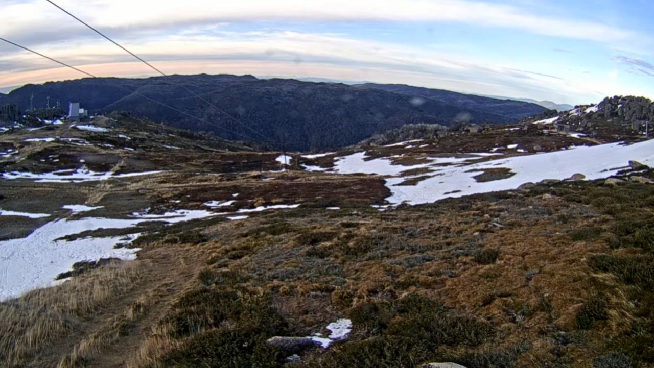
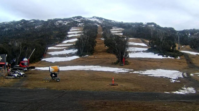
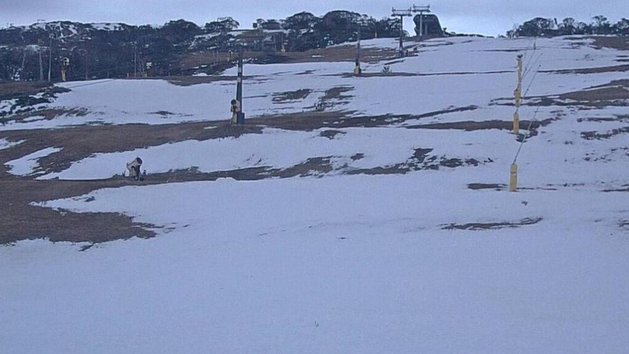
Stills taken from livestreaming ‘snow cams’ stationed across Mount Kosciuszko National Park show patchy cover across the slopes, leaving keen skiers with a less-than-ideal opening weekend.
And with an El Niño predicted for this year – bringing warmer temperatures and less snowfall with it – meteorologists are warning skiers to curb their enthusiasm.
The Bureau of Meteorology has described Australia’s snow season as “notoriously fickle”, with seasons able to turn from good to bad and back again within a day.
Sometimes we are treated to deep snowcover for months on end – like in 1964 and 1968 – and other years our slopes will get barely enough snow to cover the grass – like in 1973 and 2006.
But, sometimes, the season can turn in a single weather event, like the 2014 “Snowmageddon” event which dropped about a metre of snow in less than a week.

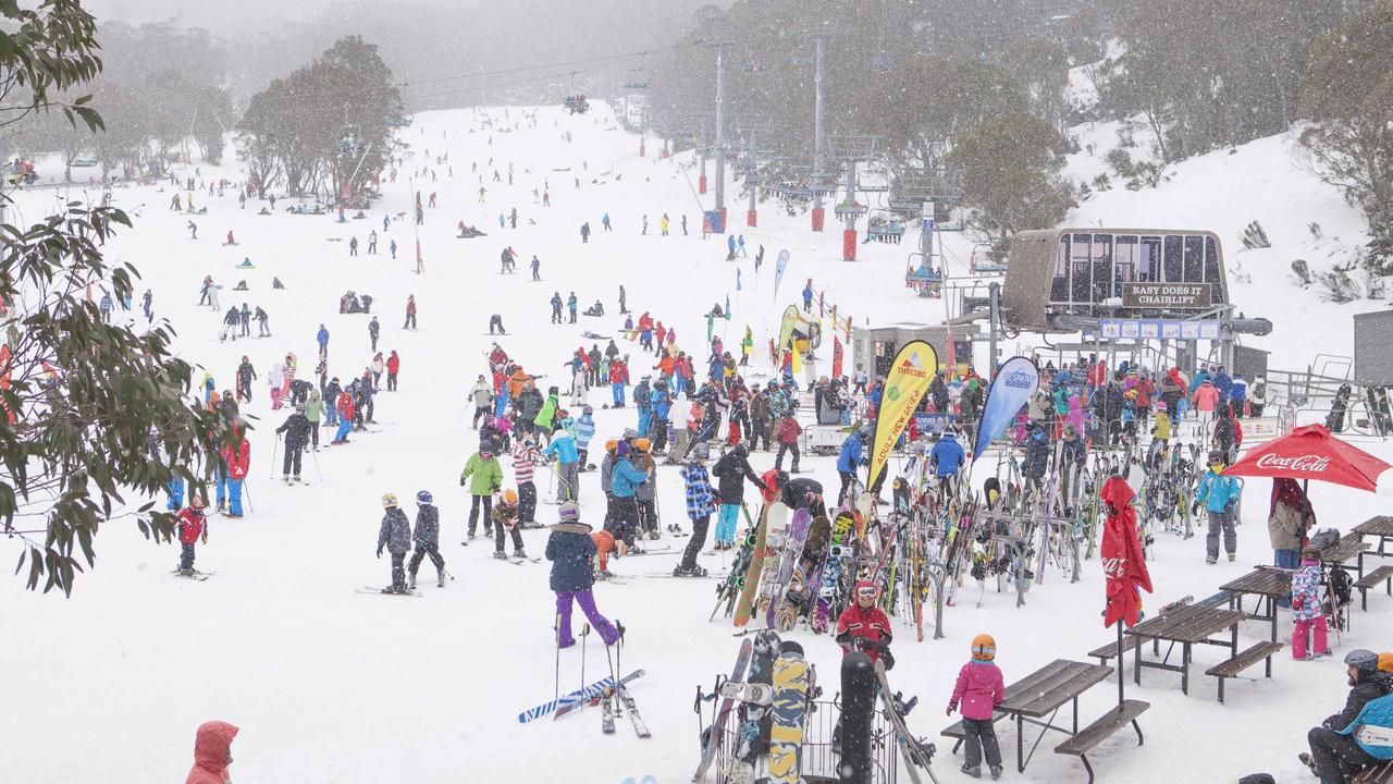
The NSW and Victorian alps were coated in a thick layer of snow in 2014, making for a bumper ski season. Picture: Supplied
Although it is hard to cast a long-term prediction of how the snow season will pan out, meteorologists have a few tricks up their sleeves.
The best measure of snow coverage in Australia is sourced from Spencers Creek in the NSW Snowy Mountains, where Snowy Hydro’s regular snow depth measurements have closely correlated with falls generally across mainland alpine regions.
The average depth of snow measured at Spencers Creek between 1955 and 2022 is just less than 198cm. In 2022, the snow reached a depth of 232cm.
Meteorologists have also found that changes in Indian and Pacific Ocean temperatures – which influence the rainfall and temperature patterns – also influence snowfall.
A 2015 study from the Bureau of Meteorology found the average seasonal maximum snow depth at Spencers Creek is around 23 per cent lower during El Niño years than when the Pacific Ocean is in a neutral state. And that effect is present throughout the whole season.
However, meteorologists have found measuring the surface temperatures of the Indian Ocean provides a better indication of whether Australia will have a bumper snow season.
Specifically a negative Indian Ocean Dipole (IOD) event has been found to increase snowfall by 20 per cent, according to ABC meteorologist Tom Saunders.
However, on average, season peak snow depths at Spencers Creek are around 26 per cent lower during positive IOD years.
In 2022 Australia experienced a negative IOD, hence the above-average snow depth at Spencers Creek.
The worst combination of Pacific and Indian Ocean climate drivers, meteorologists say, is an El Nino and positive IOD. On their own, they lead to a reduction in snowfall of 17 per cent and 15 per cent, respectively.
This combination has only happened eight times since 1960, Weather Zone reports, and was responsible for the only two years that Spencers Creek saw less than 100cm of snow: 1982 and 2006.
Other major influences are the frequency of cold fronts and low pressure systems, which cannot be predicted more than two to three weeks ahead, and climate change which is reducing the depth and accumulation of snow over the past 25 years.

Livestream still from top of the Basin T Bar, looking down at the Tredbo village (in the valley below). Picture: ski.com.au
Early signals from the oceans around Australia indicate a “lean snow season” in 2023, Mr Saunders said.
“If El Niño forms, a scenario now considered likely, then below-average snowfall becomes more probable,” he wrote.
“If El Niño combines with a positive IOD, which models currently predict, then there is every chance this year could be one of the worst snow seasons in decades.”
If there is one positive to take from a potentially dry El Nino winter is the higher frequency of clear skies that lead to frosty nights, which make for prime snow-making conditions.
So while there is still time for the season to shift, and every possibility for a freak Snowmageddon 2.0, ski fans are best to keep their fingers crossed in their mittens for some more snow.


Leave a Reply